Typical Deliverables
- Analysis-ready imagery
- Classified image products
- Feature extraction layers
- Change-detection outputs
- Segmentation masks
- Quality-controlled raster datasets
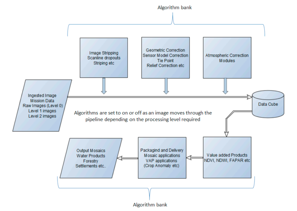
Image Processing & Geospatial Analytics
Aphelion World processes satellite, aerial, UAV and industrial imagery into analysis-ready products that support monitoring, mapping, classification and operational decision-making. Our workflows combine conventional image processing, computer vision and AI-driven analytics to extract meaningful information from complex visual and geospatial datasets.
We support large-area Earth Observation processing, feature detection, land-cover classification, change analysis and image-derived intelligence for infrastructure, environmental, agricultural, forestry and industrial applications.
Core Capabilities
- Large-volume raster processing and data preparation
- Feature detection using AI and conventional image-processing methods
- Image classification, segmentation and object extraction
- Change detection for infrastructure, settlements and land-cover monitoring
- Computer vision workflows for operational and industrial applications
Common Use Cases
- Urban growth and settlement monitoring
- Infrastructure feature extraction and asset mapping
- Vegetation, crop and forestry classification
- Environmental change and land-cover analysis
- Industrial inspection and image-based measurement workflows
Typical Workflow
1. Prepare
Ingest, clean, correct and organise imagery for processing.
2. Analyse
Apply classification, detection, segmentation and change-analysis workflows.
3. Deliver
Provide GIS-ready outputs, dashboards, reports and integration-ready datasets.